Diving deeper into earth data analysis
The below case study shares some of the technical details and outcomes of the scientific and HPC-focused programming support provided to a research project through NeSI’s Consultancy Service.
This service supports projects across a range of domains, with an aim to lift researchers’ productivity, efficiency, and skills in research computing. If you are interested to learn more or apply for Consultancy support, visit our Consultancy Service page.
Research background
Regridding, also sometimes called remapping, permeates many aspects of climate simulations. Regridding takes a field defined on a mesh and translates it to another mesh. This is often required when comparing the output from different climate models, which have their own mesh, and/or when initialising models with data from another model. With the advent of next generation climate and weather forecasting models such as LFRic, a joint effort led by the UK Met Office and partners around the world, including NIWA and NeSI in Aotearoa New Zealand, meshes have become more complex and the regridding methods developed in the past may no longer work well on these new meshes.
This is particularly true for vector fields, which tend to have components that are staggered, that is eastward components are not located at the same positions as the northward components.

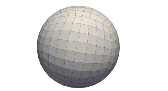
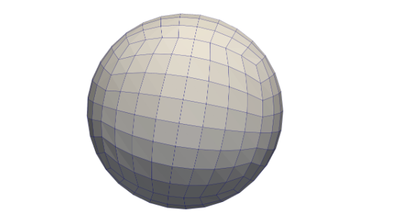
The cubed-sphere mesh used by the next generation climate and weather forecasting code LFRic is an example of a mesh with complex connectivity. Note that some cells have non-90 degree angles.
Project challenges
Vector fields require different interpolation and regridding methods than those applied to scalar fields. Vector calculus properties such as div curl = 0 and curl grad = 0 cannot be satisfied unless the regridding is “mimetic”, a property that requires the differential operators curl and div commute with the interpolation operator. Moreover, the interpolation must be adapted to the type of the field (scalar, vector, pseudo-vector or pseudo-scalar).
What was done
NeSI Research Software Engineer Alex Pletzer teamed up with scientist Christine Johnson and software engineer Stephen Worsley from the UK Met Office, and University of Exeter researcher Denis Sergeev to add vector-to-vector regridding capability to the Python earth-data analysis and visualisation package Iris.
Main outcomes
A first vector regridding implementation based on the MINT package, which is consistent with the LFRic discretisation of wind and vorticity, and conserves fluxes or circulation.

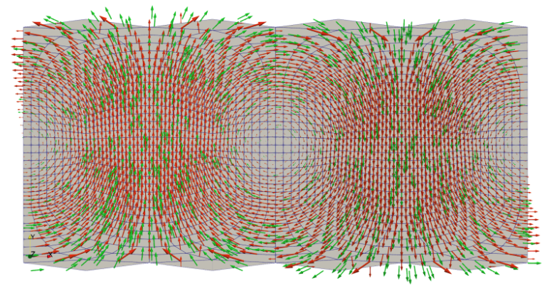
Example of regridding from a regular longitude-latitude grid to the cubed-sphere mesh, shown here in longitude-latitude space. Green represents the original field. Red is the regridded field.
Researcher feedback
"The MINT project brings a cutting edge regridding solution to the next generation of model grids. Since data will soon be stored on a cubed sphere there are many difficult open questions about regridding to be resolved. Alex has been clear and insightful in moving these conversations forward and the work we have done integrating MINT into Iris has helped prove the viability and flexibility of MINT as a solution. As a result, we are in a better position to make informed decisions about how to work with data in these next generation models and now have access to tools which go beyond previous existing capabilities."
- Stephen Worsley, UK Met Office
Do you have a research project that could benefit from working with NeSI Research Software Engineers or our Data Science Engineer? Learn more about what kind of support they can offer and get in touch by emailing support@nesi.org.nz.


